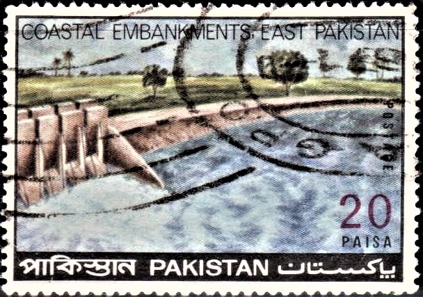
Coastal Embankments East Pakistan
A commemorative postage stamp on the Coastal Embankments of East Pakistan (now Bangladesh) :
 Issued by Pakistan
Issued on Feb 25, 1971
Issued for : Pakistan Post Office is issuing a Commemorative Postage Stamp of 20-Paisa denomination on Feb. 25, 1971 to commemorate the remarkable project relating to Coastal Embankments, undertaken by E. P. WAPDA as a valuable contribution to the economic development of East Pakistan.
Design : The format of the stamp is rectangular and horizontal. The design shows a Coastal Embankment preventing sea-water from entering into cultivated area. A portion of the sluice gates, for draining flood waters, is visible on the left side of the stamp. In the background is cultivated land with paddy fields. The caption “COASTAL EMBANKMENTS, EAST PAKISTAN“, the words “Postage” on the right side of the stamp and “Paisa” below the value, are in black colour. The value is in red colour. The black strip at the bottom of the stamp bears the words “Pakistan” in Bengali, English and Urdu in reverse.
Type : Stamp, Postal Used
Denomination : 20 Paisa
Colour : Red, Yellow, Blue and Black
Size of stamp : 50.8 x 35.2 mm.
Size of print : 47.8 x 32.2 mm.
Perforation gauge : 13 x 13 (C)
Quantity printed : 15,00,000
Number of stamps in each sheet : 50
Process of printing : 4–colour Litho Offset
Printers : The Pakistan Security Printing Corporation Ltd., Karachi
About :
- The Coastal Embankment Project is one of the outstanding undertakings of East Pakistan Water and Power Development Authority. Passing through the districts of Khulna, Bakerganj, Noakhali and Chittagong and parts of Jessore, the coastal belt stretches over 330 miles along the Bay of Bengal. It extends from the Indian border on the west to Burma border on the east.
- With its peculiar geographical position being situated on the apex of the Bay of Bengal, East Pakistan witnesses very difficult climatic conditions and is frequently visited by cyclonic storms, tornadoes and tidal bores. The night of 12th Nov. 1970 in the coastal areas of East Pakistan was undoubtedly the worst in living memory. Most of the lands in the coastal areas of East Pakistan lie below the high-tide level and are, therefore, flooded if not protected by dykes and embankments. When the land is flooded by sea waters, it leaves a layer of soil on the ground and makes the land unfit for cultivation until the salt is leached down by rain water. When any area is enclosed by dykes, it becomes necessary to provide arrangements to drain out the accumulated rain water from within the embankment area. This drainage is governed by the tide levels in the rivers i.e. water will drain out as long as the level in the river remains below the land level. Most of the lands in these areas have been brought under cultivation by farmers who put up some sort of low dykes (bunds) along the banks of the rivers but not much could be done by them against the ravages of tidal bores and in-rush of sea-water.
- The East Pakistan Water and Power Development Authority has prepared the Coastal Embankment Project to provide for properly designed embankments which are strong enough to withstand the pressure of sea water and for sluices gates which will automatically drain out water from within the embanked areas. In preparing the project, the embankments have been aligned in such a manner that all major tidal rivers and routes of navigation have been kept open. The embankments have been designed to withstand normal tide levels and surges. These will be provided with flap gates on the river side which will open automatically when the tide level goes below the land level and will close when it is higher than the water level.


